TUFLOW Viewer update, new documentation, new features, tool enhancements and future plans.
"The TUFLOW QGIS plugin turned five years old in April this year. In this short time it has been downloaded over 50,000 times. The popularity of QGIS and the TUFLOW plugin, either as part of, or the sole GIS package for TUFLOW modelling, is reflected by the 5-star rating in the repository and the steadily rising download rate we are seeing for the toolkit. Thank you for your support, encouragement and suggestions. Your feedback is what inspires us to continue adding new features."
Ellis Symons, TUFLOW GIS Integration Lead
The all new user documentation for TUFLOW Viewer and other TUFLOW plugins is consolidated within the QGIS Tips and Tricks >> TUFLOW QGIS Plugin section of the TUFLOW Wiki. Please check it out and any constructive feedback appreciated.
Updating the user documentation for TUFLOW Viewer has been a major priority this year. We made good use of our downtime during COVID-19 lockdown in the UK by adding over 70 new pages to the TUFLOW Wiki for the TUFLOW Viewer. The benefit of hosting this information on the Wiki instead of within a traditional Word or Pdf document is we were able to include videos demonstrating the tasks, options or features highlighted in the respective reporting sections. We expect this addition to the reporting will be appreciated by all. Visit the TUFLOW Viewer page of the Wiki to access the new user documentation.
Documentation for the Australian Rainfall and Runoff (ARR) to TUFLOW tool has also been updated on the Wiki to reflect recent updates to the tool that were made to stay in step with recent guidance from the ARR team. Visit the ARR to TUFLOW page of the Wiki for more information.
There have been several significant new TUFLOW QGIS plugin tools released in the past year:
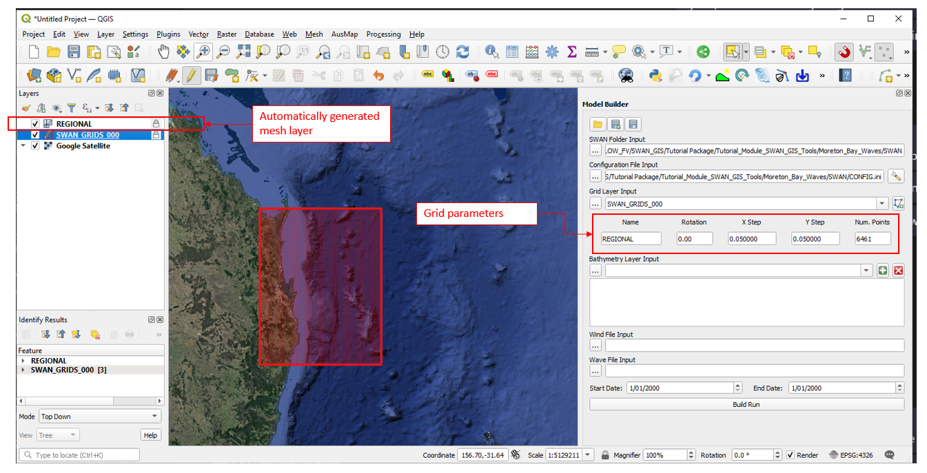
In addition to the new user documentation and features, we have also been busy working on numerous enhancements and updates to existing tools in the TUFLOW QGIS plugin. Some highlights include:
A full list of all updates can be found in the Changelog for the TUFLOW plugin in the QGIS Plugin Manager.
Planned future developments for the second half of 2021 include:
If you have any suggestions for new features of enhancements to existing features please email them to support@tuflow.com. We look forward to hearing from you.
General TUFLOW news.
TUFLOW Classic/HPC 2020-10 release update and what's coming in the 2021 release.
TUFLOW FV's new release news, staff update and user education information.
2021 TUFLOW UK/Europe Conference, Webinars, eLearning and Instructor Guided Training Schedule.