TUFLOW uses Geographic Information System (GIS) software for the creation of model inputs and visualisation of spatial results. Numerous GIS toolkits and plugins have been developed to increase user workflow efficiency in this work environment.
TUFLOW models are traditionally built and interrogated using Geographic Information System (GIS) software.
TUFLOW engines seamlessly integrate with GIS software. Any GIS or Computer Aided Design (CAD) package can be used provided save or export in set formats is supported. The most commonly used GIS software are ArcGIS, ArcPro, MapInfo and QGIS. Due to the widespread use, customised toolkits and plugins have been specifically designed for these GIS packages to improve model build and result viewing workflow efficiency.
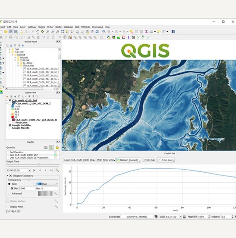
QGIS is an open source GIS package used globally to create TUFLOW models and analyse simulation results. The TUFLOW Plugin is a freely available from the public QGIS plugin repository. The Plugin includes a range of tools to increase the efficiency of development tasks.
For example, the 1D pipe integrity tool can be used to quality check complex urban stormwater pipe network datasets before conversion to a TUFLOW model. For Australian users, the plugin includes an automated tool to source and format boundary condition information from the Australian Rainfall and Runoff datahub. Similar automated boundary condition ReFH2 tools exist for United Kingdom users.
Download and install QGIS for free. Click below for notes on the TUFLOW Plugin.
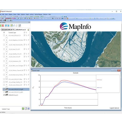
The MapInfo and TUFLOW Productivity Utilities (miTools) is a TUFLOW Software Product that has been developed specifically to improve the efficiency of setting up and reviewing TUFLOW models. The suite of utilities enables ‘automation’ of many of the common repetitive tasks, saving valuable time and money. The utilities also enable efficient creation and visualisation of TUFLOW model data within the MapInfo environment, as well as offering data checking and quality assurance functionality.
Refer to the Downloads page for the program files and manual. The following link outlines functionality built into MiTools.
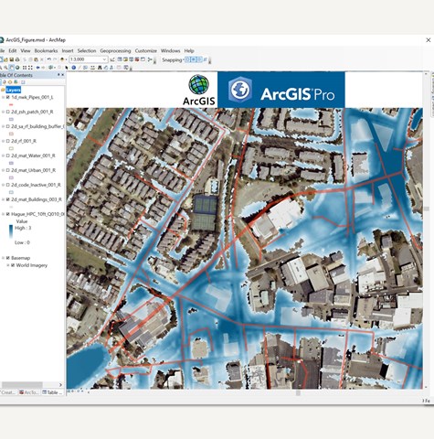
The ArcGIS TUFLOW toolbox is a free ArcGIS and ArcPro add-on. It includes a range of tools to improve the efficiency of building, running and viewing TUFLOW results within ArcGIS.
Available tools include a 1D and 2D timeseries result viewer, as well as a range of model build tools. For Australian users, the toolbox also now includes options to source correctly formatted hydrologic inputs from Australian Rainfall and Runoff (2016) datahub. A quick access toolbar has been added to the latest release, allowing uses to initiate TUFLOW utilities from within Arc using a single click.
Visit the Downloads page for the Toolbox files. The following link outlines functionality included in the free toolkit.